
The Road That United a Kingdom


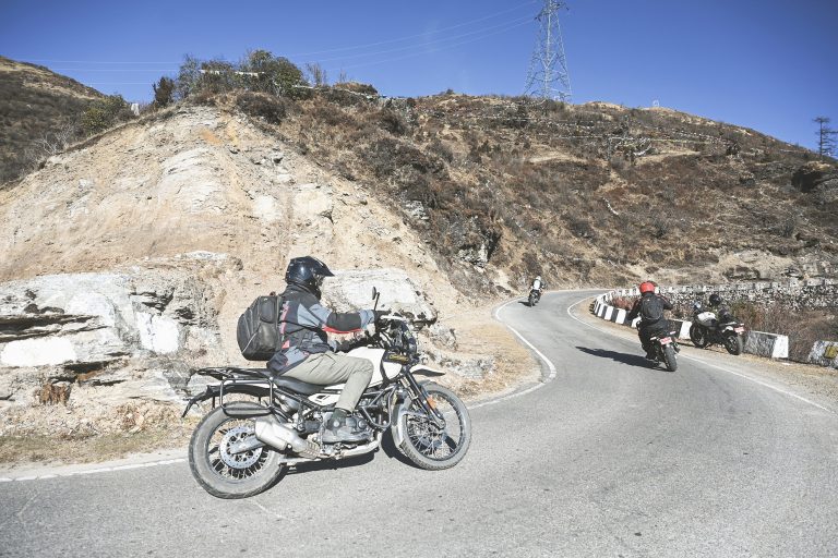
Bhutan’s East–West highway is far more than a line on a map. Experienced today on Bhutan motorcycling tours, it is a living record of how scattered valleys, rulers, and regional powers became a single, unified kingdom.
Every mountain pass it crosses once marked a frontier — political, cultural, climatic, or spiritual. Long before the road existed, these passes determined who could rule, who could trade, and who could move. Riding them today is to follow the same corridors that shaped Bhutan’s history.
Before the 17th century, Bhutan was not a single country in the modern sense. It was a land of independent valleys, each centred on fertile river basins and protected — or isolated — by steep mountains. Valleys such as Paro Valley, Thimphu Valley, Punakha Valley, Trongsa Valley, and Bumthang Valley developed their own power bases, often ruled by local lords and religious leaders. Movement between them depended entirely on high mountain passes. In winter, many were impassable. In summer, monsoon rains turned trails into hazards. Control of these routes meant control of influence.
The key to ruling Bhutan was never just the valleys — it was the gateways between them. Dzongs were built not randomly, but strategically: at river confluences, valley mouths, and approach routes to major passes. Whoever held them could tax trade, move troops, and project authority. This system reached its turning point under Zhabdrung Ngawang Namgyal, who arrived in Bhutan in the early 17th century. Through a combination of spiritual authority, military strategy, and political vision, he unified western and central Bhutan for the first time. Key dzongs such as Punakha Dzong and Trongsa Dzong became pillars of power. Trongsa, in particular, controlled the crucial east–west routes through central Bhutan — making it the strategic heart of the country. The same passes riders cross today were once decisive corridors of control.
Dzongs and Power: Controlling the Passes
Dochula Pass (3,100m) rises gently above the western valleys, linking Thimphu with Punakha and forming one of Bhutan’s most symbolically important crossings. From the prayer-flag-lined summit, the road drops steeply through forest toward the fertile Punakha Valley floor, once the kingdom’s winter capital. Authority flowed between Tashichho Dzong in Thimphu, seat of governance, and Punakha Dzong below, where religious legitimacy anchored political power. Control of this descent was essential in binding western Bhutan together.
Pele La (3,420m) marks a more dramatic transition, both geographically and culturally, standing as the traditional boundary between western and central Bhutan. From its open yak-grazed slopes, the road plunges toward the broad valleys controlled by Wangdue Phodrang Dzong, before climbing again toward the commanding heights of Trongsa Dzong. Perched high above the Mangde Chhu, Trongsa controlled the critical east–west corridor, its position so powerful that its governors would later emerge as Bhutan’s kings.
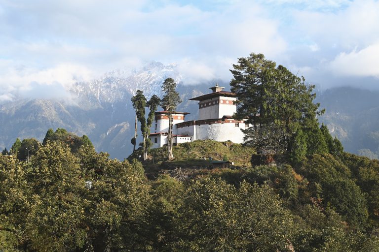
Yotong La (3,425m) guards the approach to Bumthang, Bhutan’s spiritual heartland. From the windswept summit, the descent opens into the Chokhor Valley, where ancient temples and pilgrimage sites cluster on the valley floor. Overlooking this sacred landscape stands Jakar Dzong, its position ensuring that access to Bumthang — and the spiritual authority it conferred — remained firmly controlled.
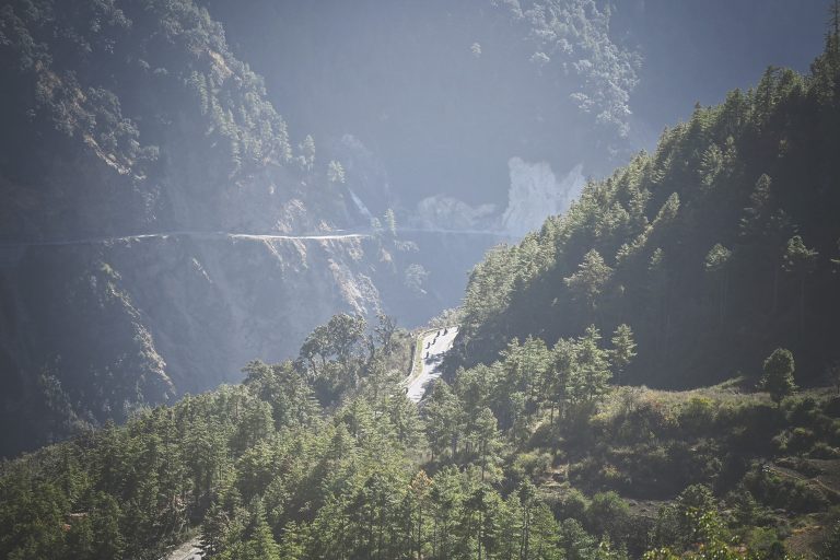
Thrumshing La (3,780m) is the highest and most formidable of the crossings, forming a stark climatic and ecological divide between central and eastern Bhutan. From alpine heights often shrouded in cloud, the road drops dramatically into warmer, deeper valleys, signalling entry into a very different world. These eastern routes were once overseen from strongholds such as Lhuntse Dzong, ancestral home of Bhutan’s royal family, and later Mongar Dzong, which anchored royal authority far from the western heartlands. Securing this descent was the final step in knitting the eastern regions into a unified kingdom.
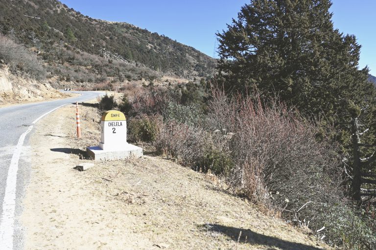
Chele La (3,988m) sits high above the western valleys, forming a dramatic link between Paro and the remote Haa Valley. Unlike the great east–west passes, Chele La was never about unifying the kingdom. Its role was frontier-facing — seasonal, strategic, and intensely local. Chele La reminds riders that not every pass shaped history — some simply guarded the edges of it.
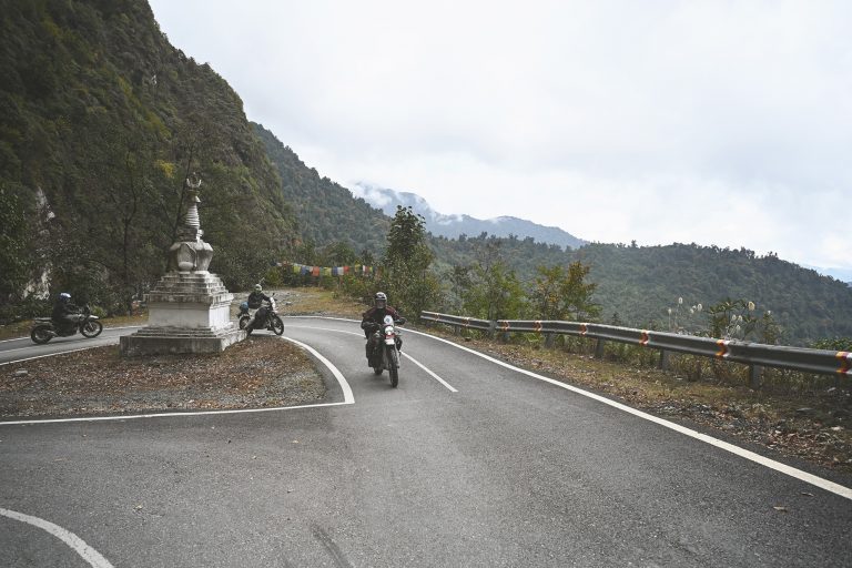
Each pass marks a threshold — from high winds to warm valleys, from one culture to another, from one sphere of power to the next — and it is this constant sense of transition that riders still feel today as the road rises and falls across Bhutan.
Beyond Thrumshing La: The Eastern Frontier
Historically, Thrumshing La was not the end of the journey — it was the beginning of Bhutan’s longest and most isolated frontier. Beyond it lay eastern Bhutan: vast valleys, deeper rivers, and communities oriented toward Assam and Tibet as much as toward central Bhutan. Places such as Lingmethang, Mongar Dzong, and Trashigang Dzong became vital outposts of royal authority. Reaching them before the road era could take weeks. This isolation explains why eastern Bhutan retained strong regional identities — and why unifying it required not just military control, but reliable access.

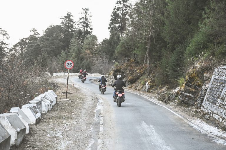
Riding the East–West Road Today
For Dragon Riders, this road is not about speed. It is about continuity.
Every climb echoes the footsteps of traders and pilgrims. Every descent follows the logic of history. From the cool forests of Dochula to the long eastern valleys beyond Thrumshing La, you are riding the same lines that once defined power, unity, and survival. This is why the East–West road matters. It didn’t just connect places — it created a country.
If you ride all five passes once in a logical “Dragon Riders” sequence, you can estimate total climbing/descending by linking each pass to the main valley floors on either side, west → east:
Paro (2,200m) → Chele La (3,988m) → Haa (2,720m) → Thimphu (2,320m) → Dochula (3,150m) → Punakha (1,242m) → Wangdue (1,273m) → Pele La (3,420m) → Trongsa (~2,120m) → Yotong La (3,425m) → Jakar (2,587m) → Thrumshing La (3,780m) → Lingmethang (~650m)
Of course, these are not the only passes in Bhutan. Beyond the great crossings of the East–West road, many more ridgelines and thresholds shape the journeys we ride. On our routes to the south along the Dragon’s Path, and on the longer arc of the Tour of the Dragon, we cross additional passes, descend into warmer subtropical zones, and climb again into landscapes that feel entirely different from those before. Each journey threads together multiple regions, cultures, and histories — from ancient dzongs and trade valleys to modern towns and living traditions. Taken as a whole, our rides traverse the full breadth of Bhutan’s extraordinary geography and story. To ride these roads is to move through time as much as terrain — and there is little doubt that they offer some of the finest mountain motorbike experiences anywhere in the world.